The Trip
Dates: July 5-7, 2018
Distance: 24 miles
Elevation: Negligible 🙂
Entrance: Mattole Beach
Exit: Black Sands Beach
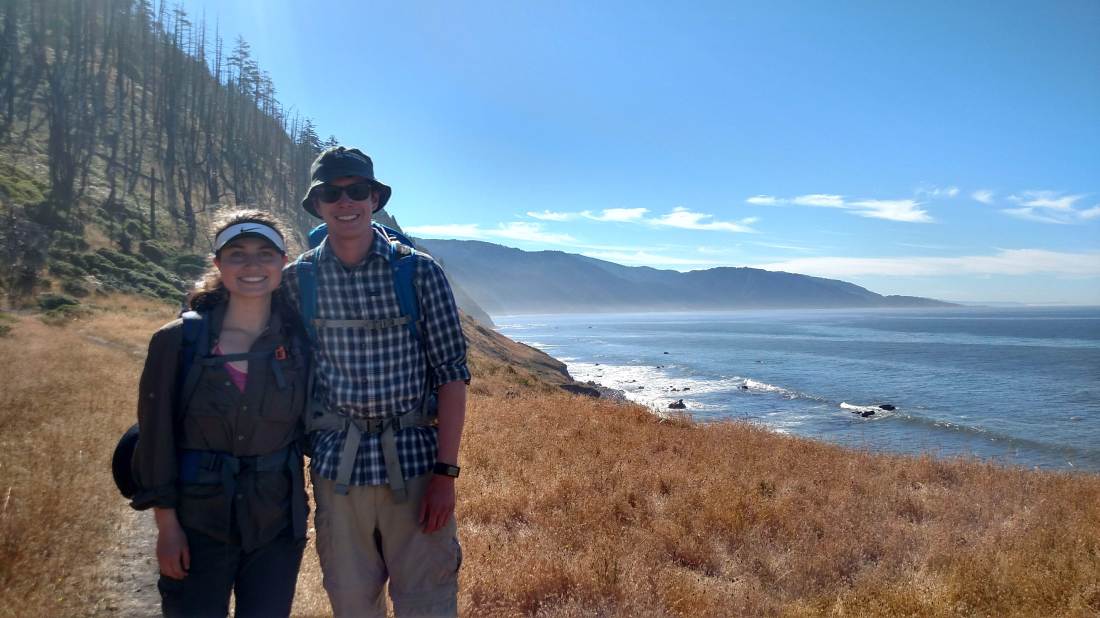
Crew: Casey Duncan, Trevor Lower, Hannah Neville, and yours truly
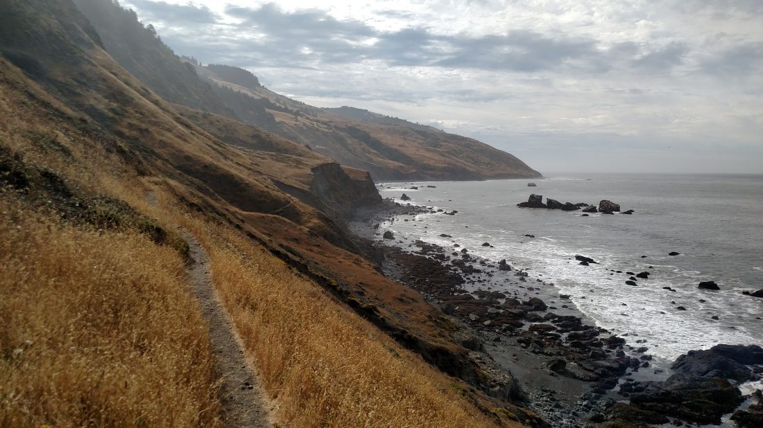
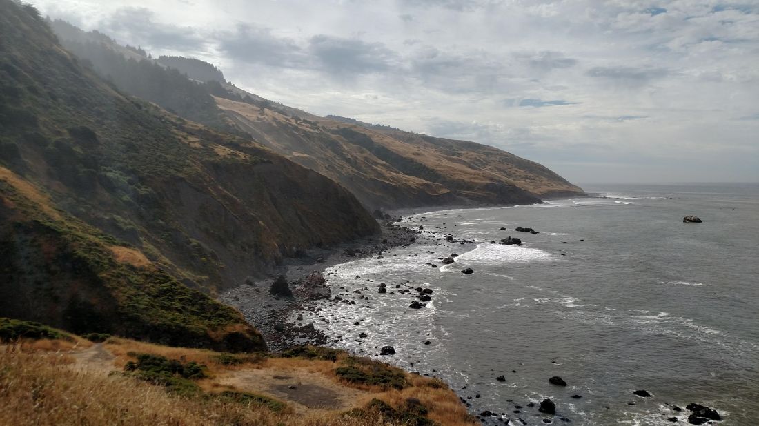
California’s Lost Coast is a remote region of ocean coastline several hours drive north of San Francisco. Its rugged terrain forced highway engineers to divert Highways 1 and 101 inland to avoid the steep and unstable hillsides. Lacking a practical industry or even road system, the area was spared from the aggressive development found elsewhere on the California coastline.
Today, the northern half of the Lost Coast is a popular backpacking destination managed by the BLM as part of the King Range Wilderness. Although primarily composed of perfectly flat beach walking, this section of trail can be tricky in spots due to high winds, soft sand, and tide-dependent sections.
Beyond our exit trailhead at Black Sands Beach, the trail mostly leaves the beach and enters the mountains to continue southward through mix of land management designations. We did not explore this section of the trail on this trip, but Hannah and I plan to do so in the future.
Logistics
Permits
Although permits do not seem to be “California crazy” difficult to obtain, they are scarce on holiday weekends mid-season. A quick glance shows they are currently booked for the next month. Luckily Hannah was on her A-game and reserved 5 permits for 4th of July week when the booking opened 6 months ago. Thanks, Hannah!
Food & Gear
We didn’t need anything special for this trip, nor did we need to worry much about weight for such a short and flat trip. If anything epitomized the relaxed nature of the trip, it was the canned wine Trevor and Casey found room for in their packs. Bear canisters are legally required, and although we didn’t see any bears on this trip, there were plenty of critters who would just as happily steal some trail mix.
Transportation
They don’t call it the “Lost” Coast for nothing. Reaching the redwood forests of Humboldt County via 101 is only half the battle. From there, a large portion of the drive in is on small backroads, where you’re a lot more likely to find a pot farm than cell phone service. We took two cars and shuttled, leaving Hannah’s Subbie parked in Shelter Cove at the southern terminus of our hike.

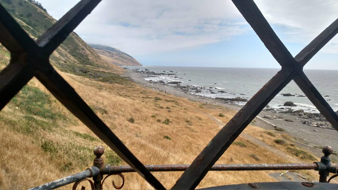
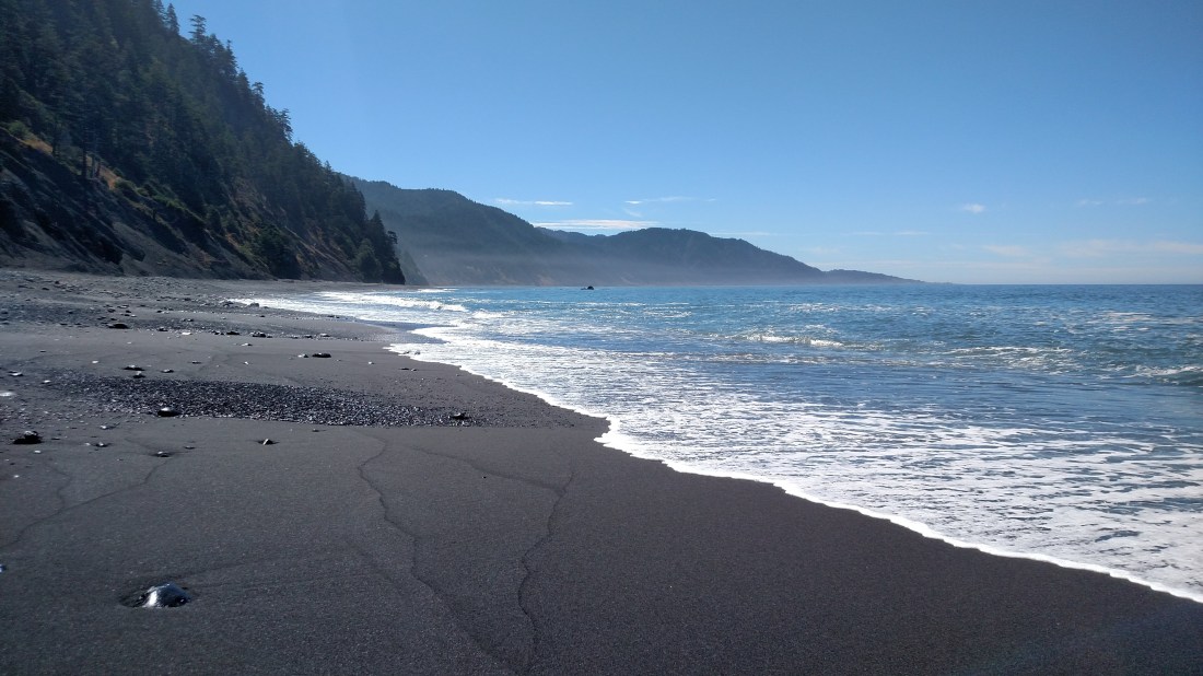
- View from the parking lot of Black Sands Beach in Shelter Cove
Day 1: Mattole Beach to Punta Gorda Lighthouse
“Jeez, it’s [unintelligible]!”
“It’s what?!”
“I said it’s [unintelligible]!”
“WHAT?!”
“IT’S WINDY!”
Such went conversation the first hour or so of the trip. The all-natural exfoliation from the constant sandblasting was a bit invigorating, but I was glad nonetheless when the headwind taper off as we rounded Windy Point.
Not long into the afternoon, we reached the Punta Gorda lighthouse. This lighthouse operated from 1912 until 1951, when it was deemed to costly to operate and replaced with an offshore buoy.
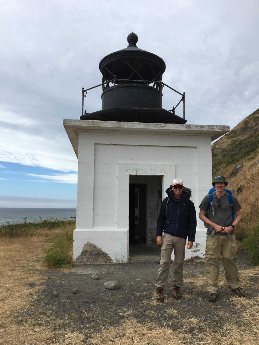
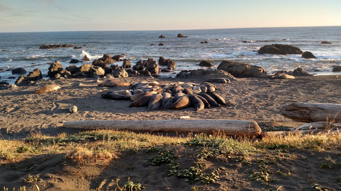
It was hard to imagine living on this chilly stretch of remote coastline with only a handful of people and the elephant seals to keep you company. The posting was so remote, in fact, that is was referred to the “Alcatraz of Lighthouses.” The rocky beaches made landing boats impossible, so the lighthouse was serviced primarily serviced by horseback.
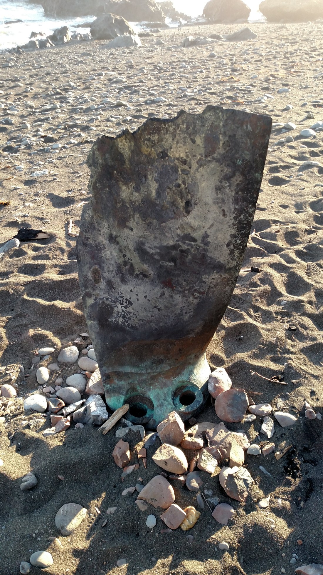
Dotting the coastline were reminders of why the lighthouse was once so necessary, including this fractured propeller blade built in the early 1900’s in San Francisco.
The rising tide prevented us getting much further that day, so we spent the remainder of the afternoon relaxing and watching the blubbery elephant seals clumsily flop their way around the beach. Reaching 8,800 lbs, the males can be twice the weight of a Ford F-150. We speculated, probably incorrectly, at what social dynamics might be going between the bulls and the harem (actual seal terminology that I had to look up).
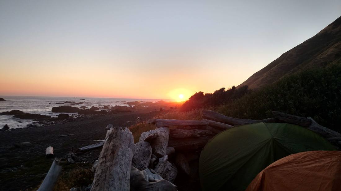
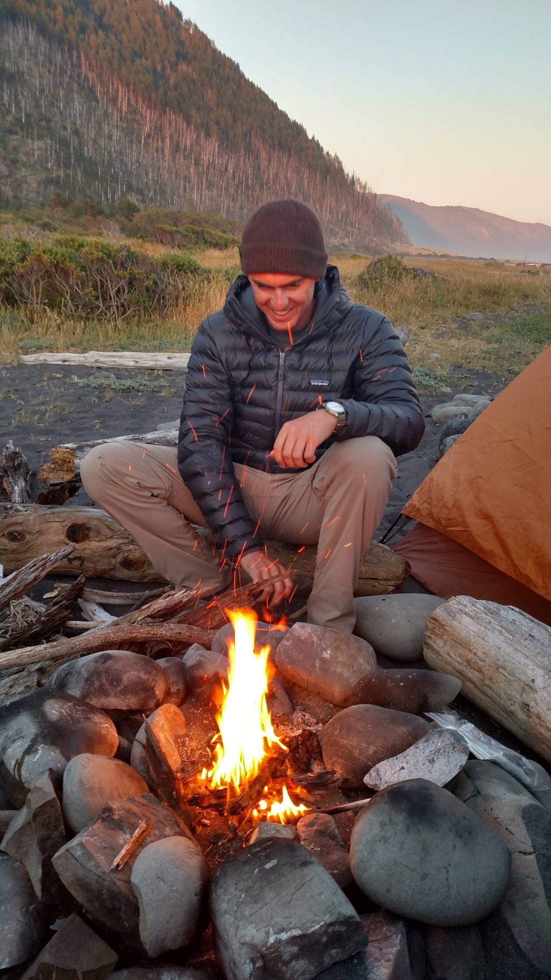
We found an unoccupied windbreak for our tents, and the wind calmed down enough to have small campfire.
Day 2: Punta Gorda Lighthouse to Big Flat
Hiking with the tides imposed leisurely itinerary throughout this trip, which was not at all unwelcome. With low tide peaking around noon, we were in no rush to get moving in the mornings.
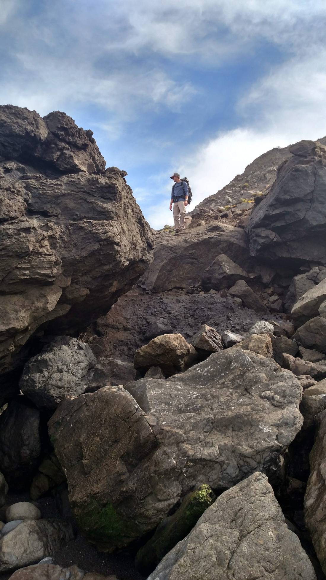
Although never overly difficult, we did pass the most scrambly sections of the trail this day. Loose and slippery boulders demanded some degree of attention in order to be safely traversed with a pack.
We mostly welcomed stretches of trail that briefly left the beach, as this offered a break from wading through the soft sand and rock. But faster travel came at a price, as the poison oak was in full bloom. Hannah and I were happy to discover we’re not particularly sensitive. (I only just learned what poison oak even looks like on this trip.) But as we discovered a week later, Trevor and Casey hadn’t been so lucky.

We passed a private home on what has to be one of the country’s coolest inholdings, complete with outdoor fireplace and airstrip, before snagging a wind shelter on Big Flat.
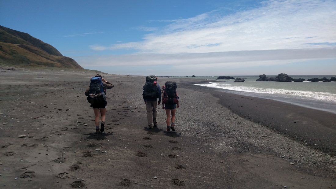
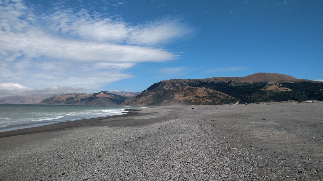
Day 3: Big Flat to Black Sands Beach
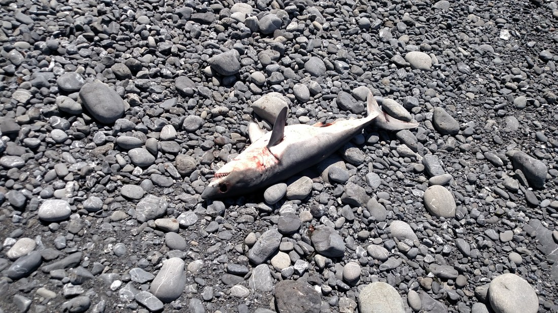
The final stretch of the trip was along hot black sands where we saw and abundance of wildlife. This included whales, seals, sea lions, dolphins, otters, deer and even a washed up baby great white shark who had been trapped in a tidepool.
By midday we were back to Black Sands Beach, where the hike to the parking lot would prove to be the hardest climb of the trip.
The Drive Home
The long and bumpy backroads had a final surprise for us as we pulled away from Mattole Beach. A protruding piece of rebar snagged Trevor’s wheel and tore out the sidewall. I was impressed to find that he and Casey were nearly done bolting on the spare by the time we arrived back 10 minutes later. Unable to find shop on a Saturday night in rural Calfornia, they managed to make it home to Ventura on the donut.
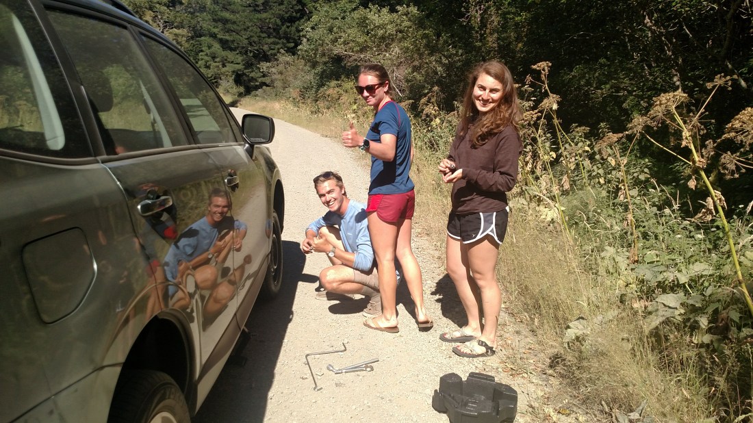
It turns out a friend from work had popped their tire on the exact same pothole a month earlier, but they were not as familiar with their jack and ended up losing most the day fixing it. So kudos to Trevor and Casey for dealing with the issue themselves and getting home safely!
Hannah and I witnessed a number of roadside calamities on our drive back through the backwoods of Humboldt County.
We had dinner with a couple of British bicycle tourers who had washed out on a steep decent and spent their day in the ER getting put back together. But after a few beers and some Mexican food, they seemed to be in a good mood for the Greyhound ride to SF. Since it seemed they wouldn’t be riding much, we made sure to give them a list of our favorite bars.
We also witnessed an old pickup lose its front wheel while traveling towards us downhill around 70 miles an hour. Remarkably, he was somehow still seemed able to steer on his remaining tire, even as sparks shot out from the underbody. We weren’t able to safely flip around to inspect the aftermath, but hopefully he managed to bring the vehicle to a stop.
Conclusion
This was a fast and fairly easy 3 day weekend trip from the Bay Area, and one that I’d highly recommend for backpackers of all levels. For the especially ambitious trail runners, it could even make for a long day hike if you could find someone to trade keys with (in which case you might not need a permit). Just bear in mind that the soft sand will slow you down significantly, and the tides will ultimately determine your itinerary.
I think we all agreed that the trail offered some fantastic variety from the Sierra hikes we’re used to, but that our hearts are still in the mountains when it comes to backpacking. I plan to return for the southern portion of the Lost Coast Trail, but probably not until the shoulder season when the temperaturess have dropped and Sierra weather has gotten dicey.
