Introduction
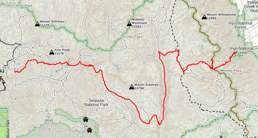
Dates: July 14-17, 2018
Distance: 73 miles
Elevation: 24,000′ up, 22,000′ down
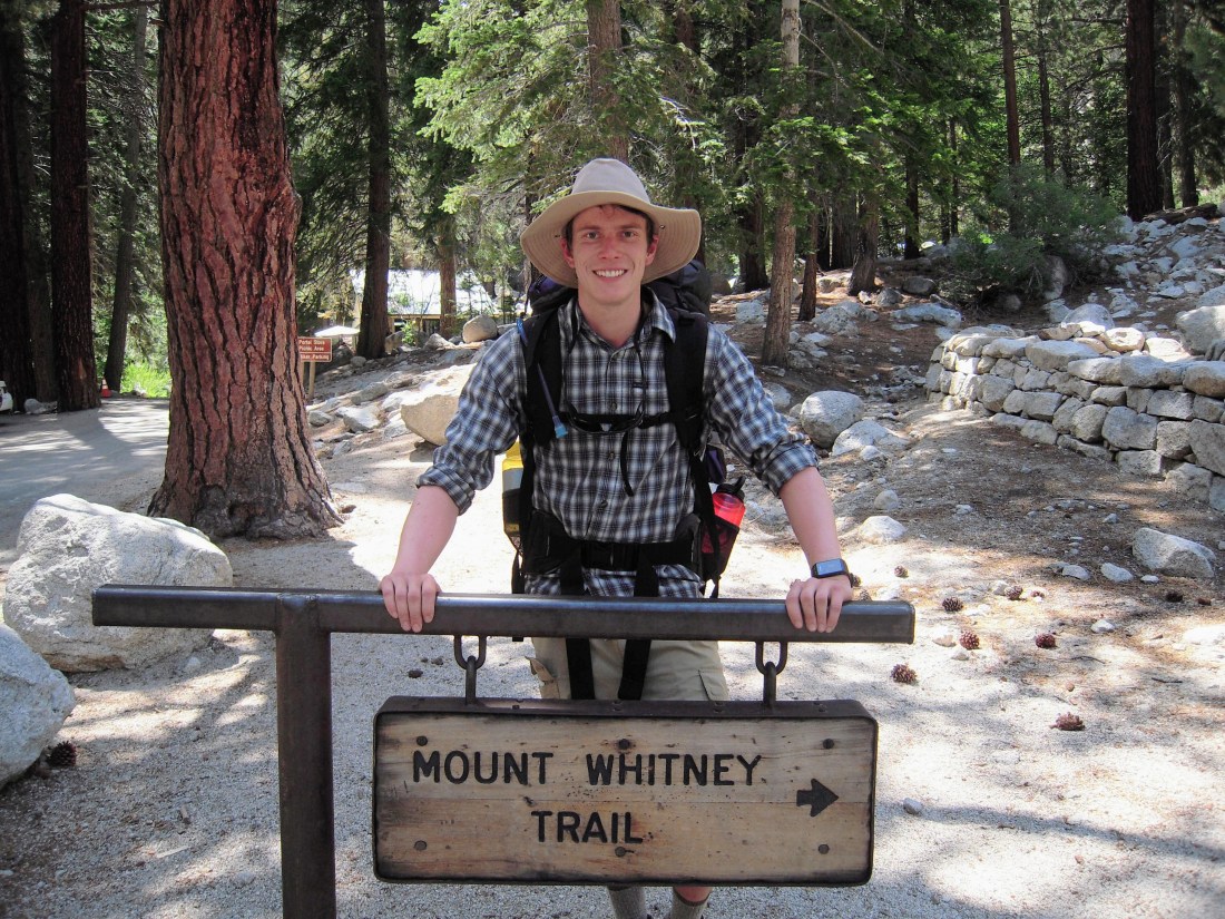
Entrance: Crescent Meadow, Sequoia NP
Exit: Whitney Portal
Inspiration for the Trip
I first heard of the High Sierra Trail while stopping to catch my breath near Trail Crest on my first trip up Mount Whitney in 2015. I was fresh off the infamous 99 switchbacks and in disbelief that I still had a couple miles to the summit when a solo backpacker reached the pass from the west. He was carrying a load that made my daypack look like hand purse and wearing enough sun protection to cross the Sahara. Naturally, I had to ask him where he was coming from, and he explained that he had spent the last week crossing the Sierra west-to-east on the High Sierra Trail. He didn’t say much else, but the odor corroborated his story. I went along huffing and puffing my way to summit thinking “why would anyone put themselves through that?”
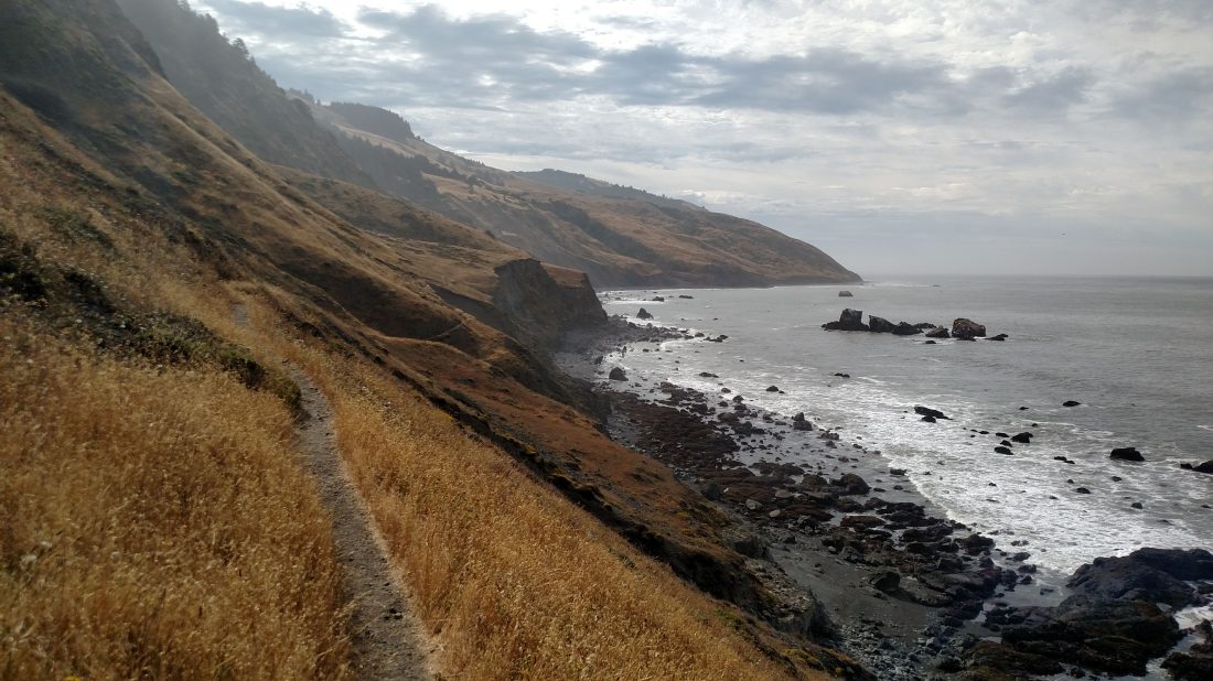
Fast-forward three years to last week on the Lost Coast Trail, where I was backpacking with my girlfriend, Hannah, my cousin, Trevor, and his girlfriend, Casey. I was looking for my next trip, possibly as something to fill the time while Hannah was traveling for the next two weeks with her family. Walking along the rugged, wildlife-filled California coastline had me stoked for exploring more trails. Trevor and Casey had recently section hiked the John Muir Trail and summited Mount Whitney via the High Sierra Trail, and their enthusiasm for the region “peaked” my interest.
Planning
The title of this section is a bit of a misnomer, as very little real planning for this trip actually occurred.
At work Monday, I killed some time waiting for code to compile by researching hikes in the Sierra. The High Sierra Trail seemed the perfect fit for someone with a week off work and not already holding a permit. But the driving logistics seemed challenging. The entrance trailhead in Sequoia National Park and exit trailhead at Whitney Portal, although only separated by 73 miles of trail (30 miles as the crow flies), are 300 miles apart by car.
I did some digging and found a years-old email thread about shuttling cars from Whitney Portal and (without much hope of a response) pinged the author to see how he had ended up managing transportation. To my surprise, I had a several responses within 20 minutes, including the offer to trade cars and hike opposite directions. To loosely paraphrase our conversation:
“Hi Grant. Trading cars is definitely the way to go. I might be interested if you’re interested :)”
“Thanks for the advice, but I’m actually planning this very last minute (this weekend!) But if I end up pushing back the date to a time you can get a permit form Whitney, I’ll be sure to let you know!”
“Actually I already went ahead and got the permit. This weekend still work?”
And so I was committed to hiking the High Sierra Trail, and I couldn’t have been happier for the kick out the door! I scrambled through the week to make sure I had the time off, gear, and food needed for the trip, and then before I knew it I was handed the keys to Philippe’s little blue Prius and off we went.
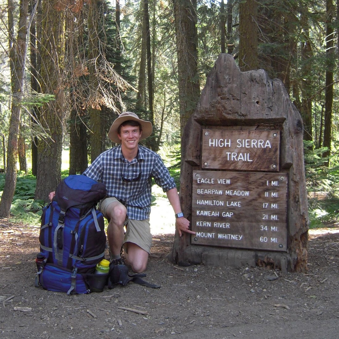
Day 1: To Hamilton Lakes
286 miles driving, 17 miles hiking, 5000’ climbing
I knew the success of my trip was largely dependent on obtaining a walk-up permit on Saturday. I had been told that this was unlikely to be a problem leaving from Sequoia NP, but I didn’t want to take my chances. I hit the road by 4am, but was pretty quickly off my pace due to frequent and necessary roadside pitstops that I can only assume were due to poor water treatment on the Lost Coast Trail.
I arrived at Sequoia by 10am and snagged the last permit the day (yay!) before running off in search of what I knew would be the last flush toilet I would see for some time. I briefly pondered whether entering the wilderness alone with a possible waterborne illness was wise, before remembering that my car was parked on the other side of a large mountain range and that I didn’t really have another plan for getting it back. (Luckily hitting the open trail seemed to clear things up for the rest of the trip.)

Clinging to my bulky pack loaded for 6 days on the trail, I packed into the sardine can of a bus hauling sweaty tourists to Sequoia’s Moro Rock. I did my best to avoid crushing the French children packed in around my knees with the backpack I’m fairly certain outweighed them. Three buses and an hour later, I was finally at the trailhead!
Within minutes of finally hitting the trail, the stress of gear prep, driving, permits, buses and desperate hunts for highway rest stops quickly melted away.

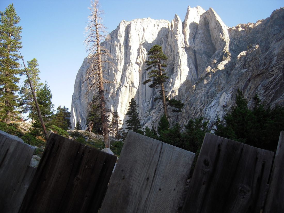
The carefully engineered HST gently climbs away from the park, offering one last glance at Moro Rock, one of Sequoia’s major attractions.
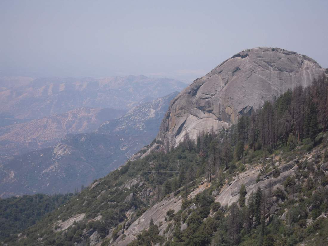
The trail designers sought easy grade for the entire length of the HST. Sometimes this meant cutting directly into granite hillsides. This practice was mostly abandoned in the later years of construction in favor non-scarring practices.
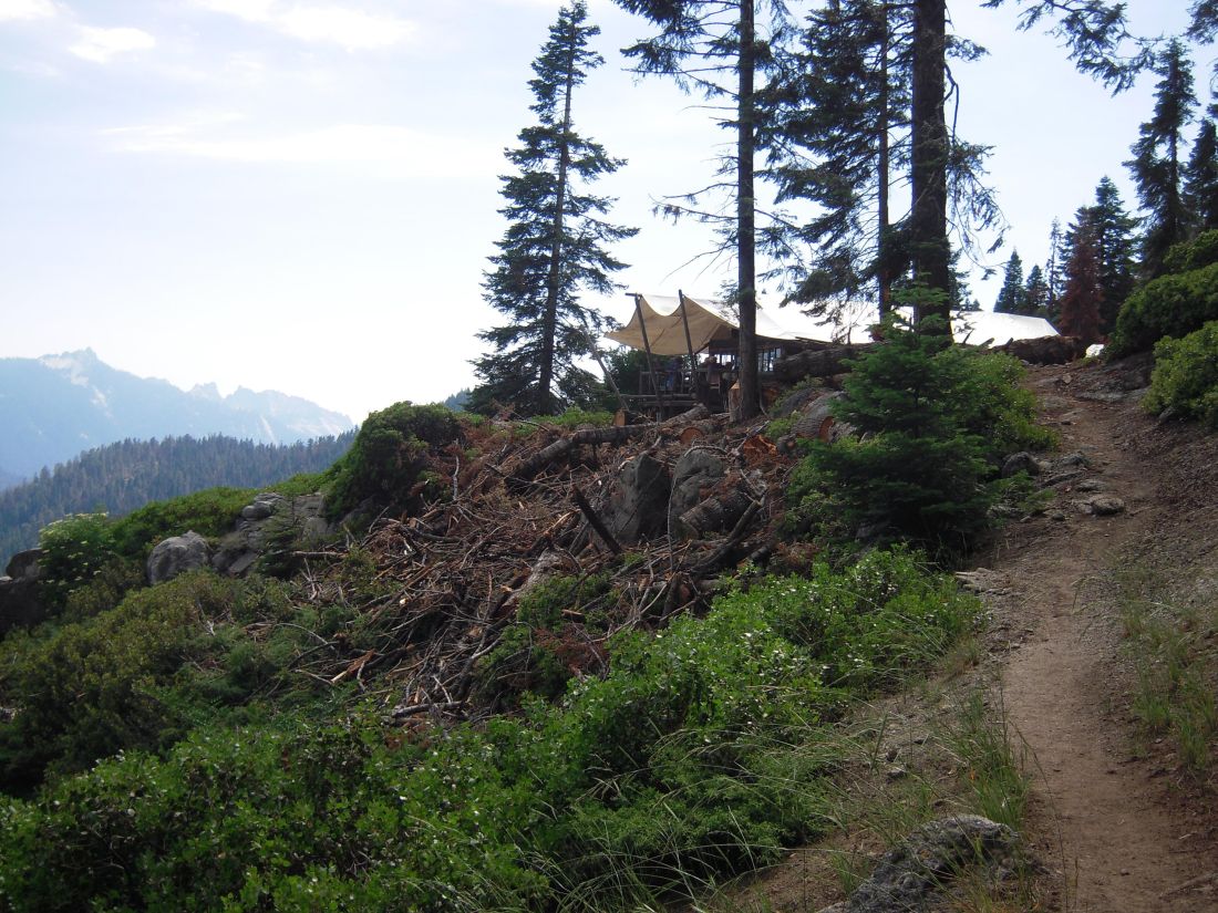
Soon I reached Bearpaw High Sierra Camp. This luxury backcountry “hotel” is 11 miles into the wilderness and is served by mules, but they don’t let cheap and stinky hooligans like me stay there. Since the nightly rate managed to even exceed my San Francisco rent, I decided to push on.
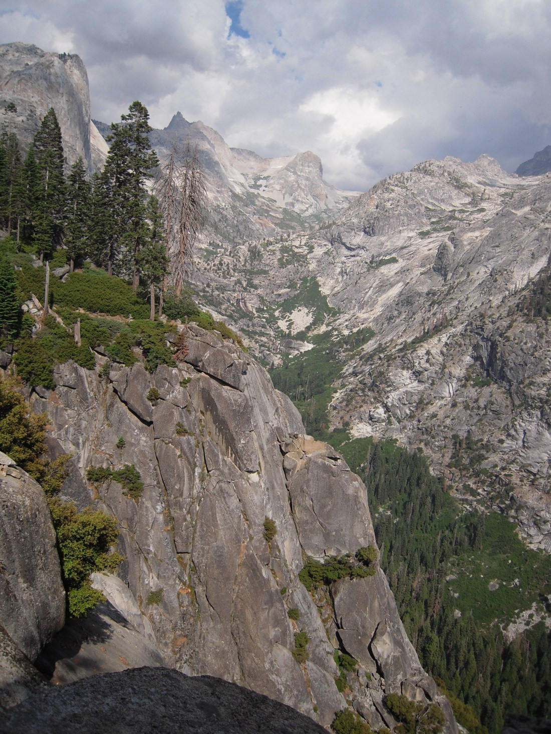
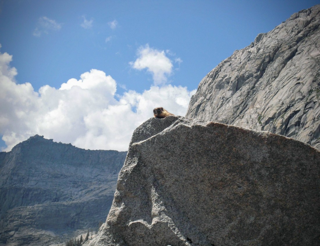
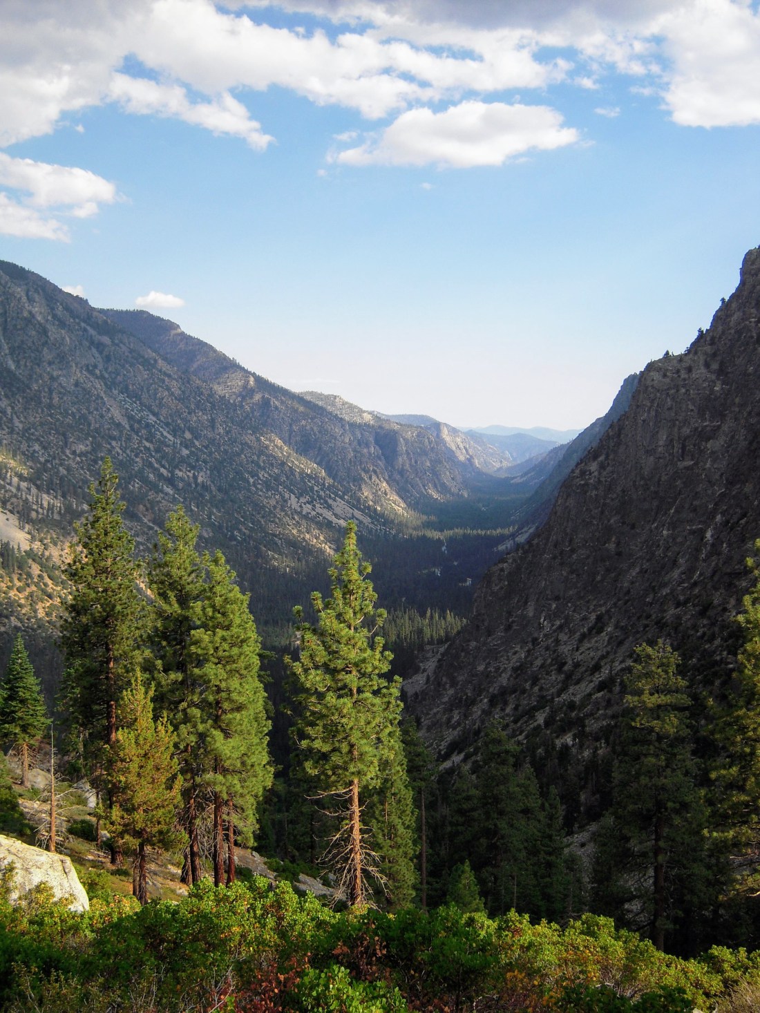
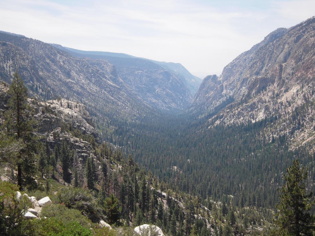
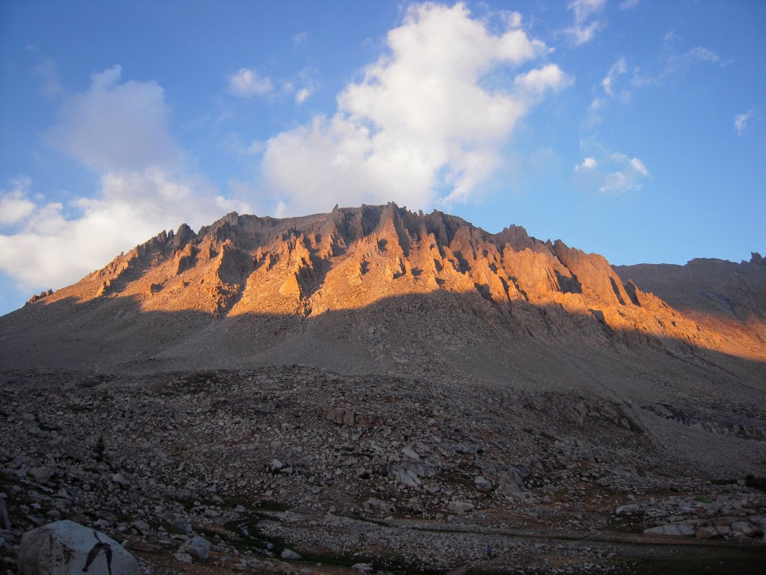
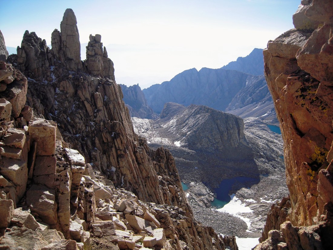
I continued towards Lone Pine Creek, where the magnitude of the mountains I would be crossing soon became evident. What I didn’t realize at the time was that these approaching peaks of the Great Western Divide would be the lowest of the crests I would be soon be crossing.
I crossed Lone Pine Creek and met one of Sequoia-Kings Canyon’s backcountry rangers. These badass rangers spend an entire season living deep in the wilderness without resupply, ready to aid a stranded backpacker or pluck a climber off of a mountain. But perhaps more impressive is that they spend the majority of their time performing the mundane task of picking up “backpacker detritus” with enthusiasm and a smile. This ranger clearly recognized the solo experience I was looking for and pointed me to a secret campsite (which I shall not reveal) so that I could enjoy some solitude away from the large groups already packed in around Hamilton Lake.

Day 2: To Kern Hot Springs
21 miles, 4,000’ climbing
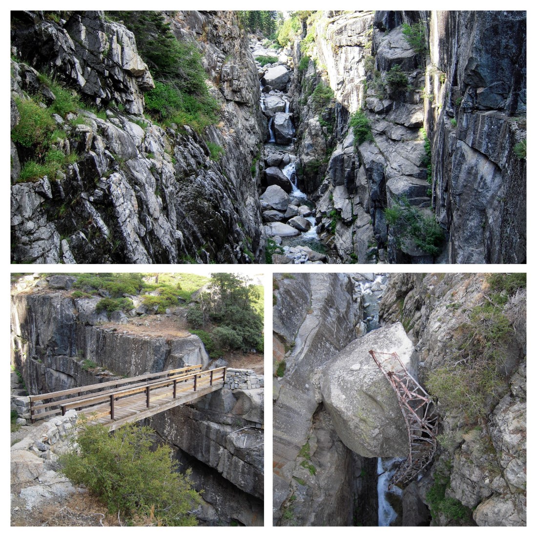
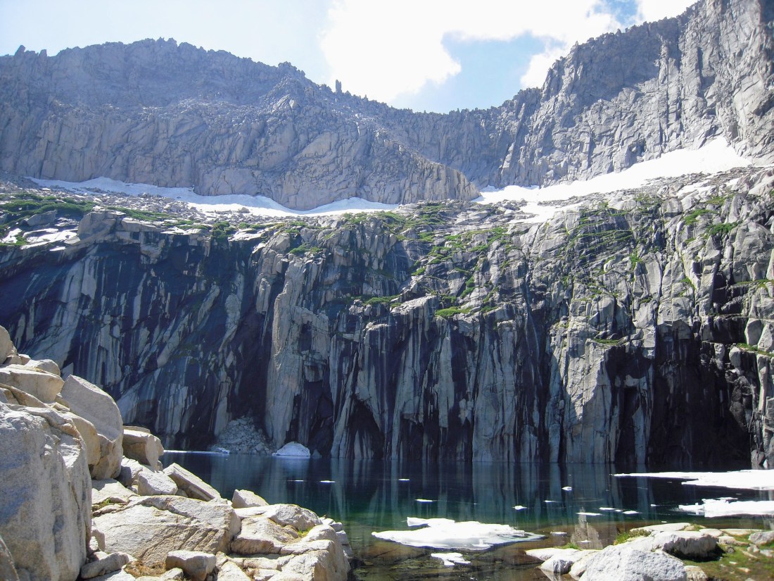
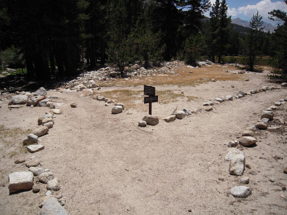
From Hamilton Lakes, the trail took a turn for the vertical and headed up Kaweah Pass (10,700’). But not without first passing one of the world’s most scenic pit toilets.
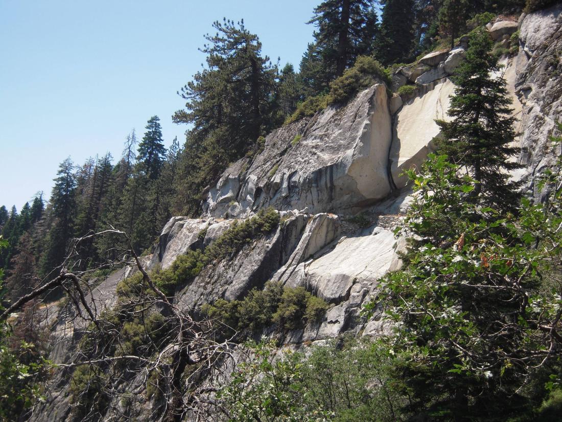
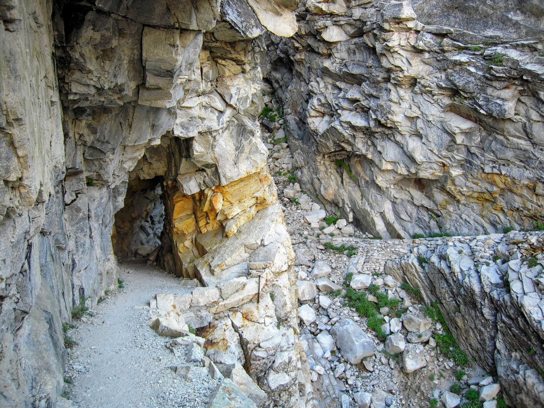
This section includes some of the most challenging construction efforts of the HST. The original suspension bridge here only lasted a few seasons before being taken out by a winter avalanche. It has since been replaced a tunnel and carefully carved trail.
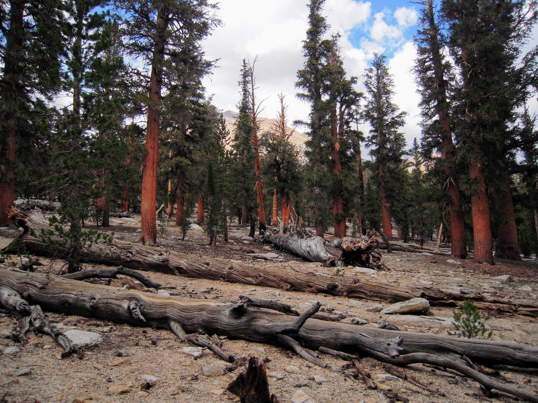
The trees thinned and the temperature dropped as I approached Kaweah Gap. Also thinning was the oxygen, which my lungs (having departed sea level only 24 hours prior) were having a little trouble keeping up with.
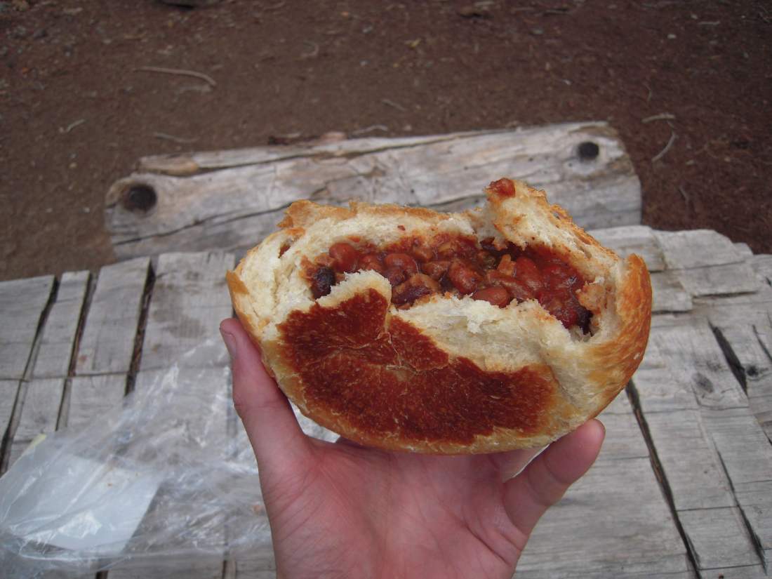
After a sporty climb, I was excited to tear into my first trail lunch, only to find I left the peanut butter at home in my pantry. I improvised and came up with what I’ve dubbed “the world’s saddest sandwich”, which was an M&M stained tortilla wrapped around unmelted cheese. But with the climb from Hamilton behind me, it was still delicious!
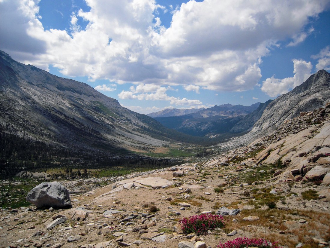
I pushed on for a number of miles through the afternoon, doing a fair bit of descending, climbing, and descending again. A trail washout spiced things up briefly, requiring me to pick my way over a gulley of loose man-sized boulders that I hoped wouldn’t so easily let loose as the hillside had days prior.
At this point I ran into my crazy westbound car exchanging buddy taking a rare break to rest his feet. He was planning to complete the whole trail in 2.5 days and carrying little but a tent and protein bars. We shook hands, traded our spare keys, commiserated briefly about mosquitos and went on our way.
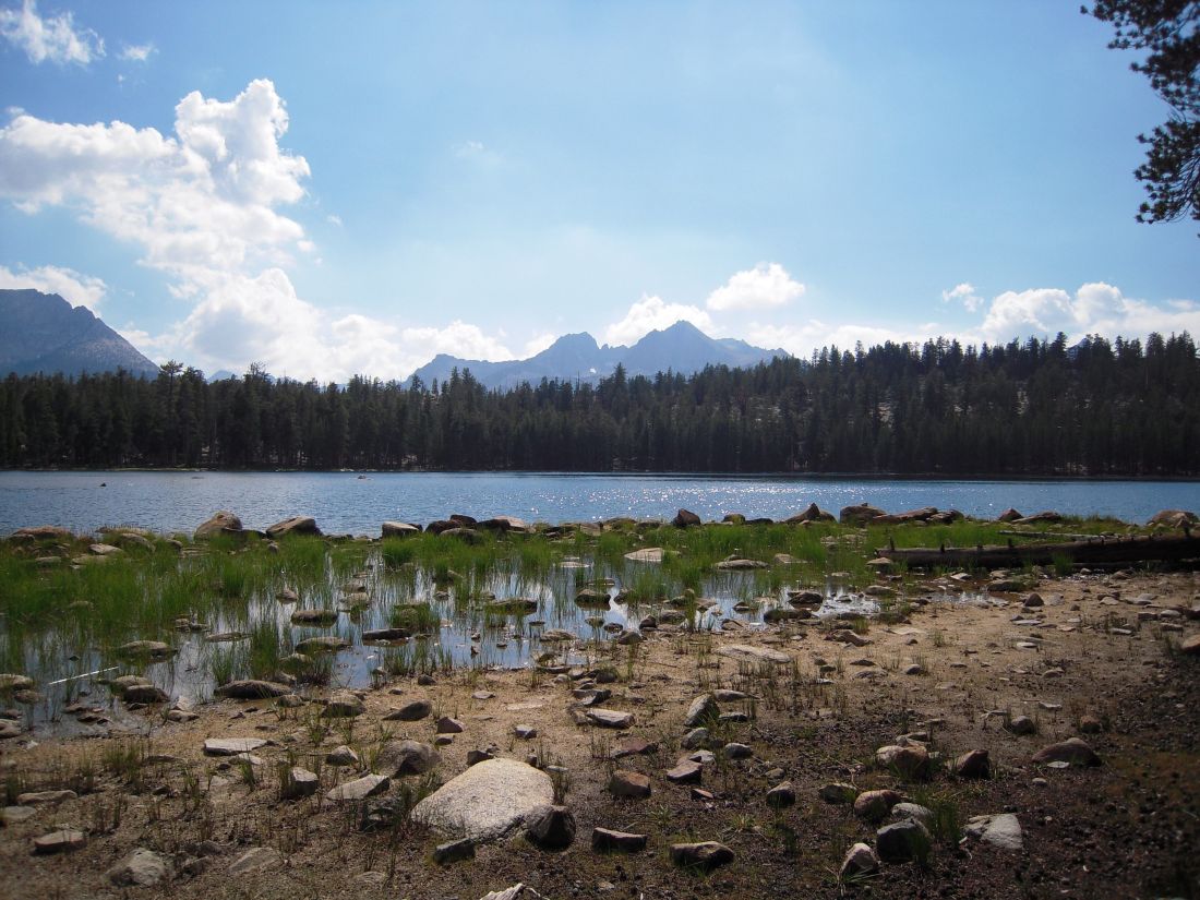
I had originally planned to stop at Moraine Lake for the night, but I decided to push on. It was only 4pm and I was still full of energy. Most important to my decision, however, was seeing my campsite neighbor pull out a ukulele. Recognizing what poor Israel Kamakawiwoʻole imitation was likely to come, I decided to push onwards to quieter pastures.
I began to worry that I might not reach my next campground before nightfall. This might not normally bother me, but that I had been warned that the next campground, Kern Hot Springs, was not only magnificent, but also crowded. I was tired and wanted to take a dip and find a vacant spot for my tent before dark. What I had forgotten that 2,400’ of steep descending stood in the way.
It’s funny how a bad thought can fester while hiking alone. I had read in some blog that Kern Hot Springs can get crowded, and for the next couple of hours I set an unreasonably fast pace to ensure I could find a campsite. I even considered how far I’d have to continue hiking if the campground was full. My fears of a crowded campsite, however, were entirely unfounded. In fact, I would go the next 24 hours without seeing another human face.
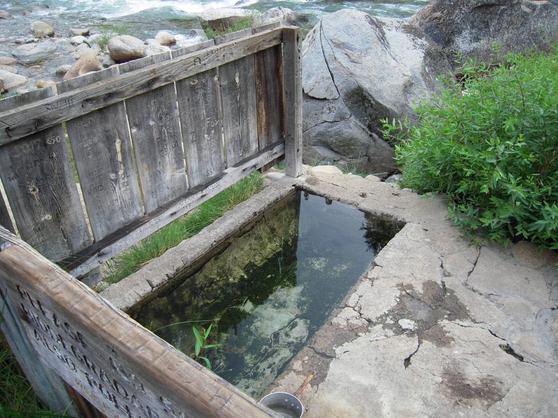
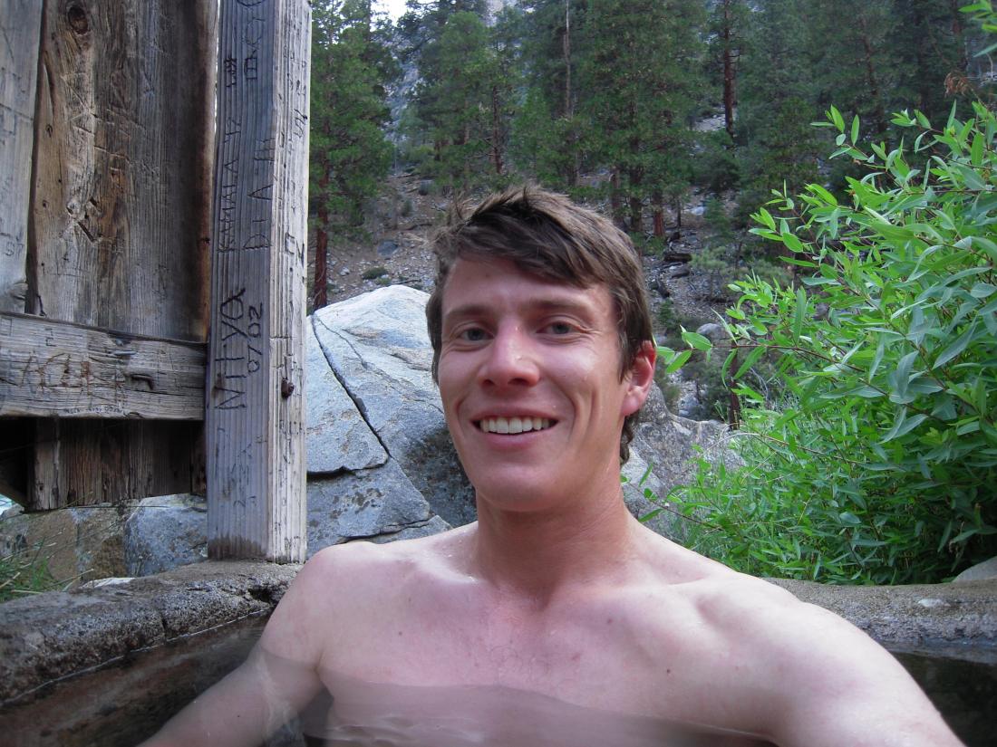
By the end of this second long day, my ambitious pace and comically heavy pack (I didn’t weight it, but let’s just say it was a multistep process to put it on when I started out) was catching up to me. Lowering myself into the spring, it felt like little clamps affixed to all my muscles were suddenly unscrewed, discarded, and carried away by the current. Floating silently in the fiery waters of the Kern and watching the fading sunlight creep up the canyon walls, I was briefly and totally in a state of bliss.
Day 3: To Guitar Lake
20 miles, 6000’ climbing
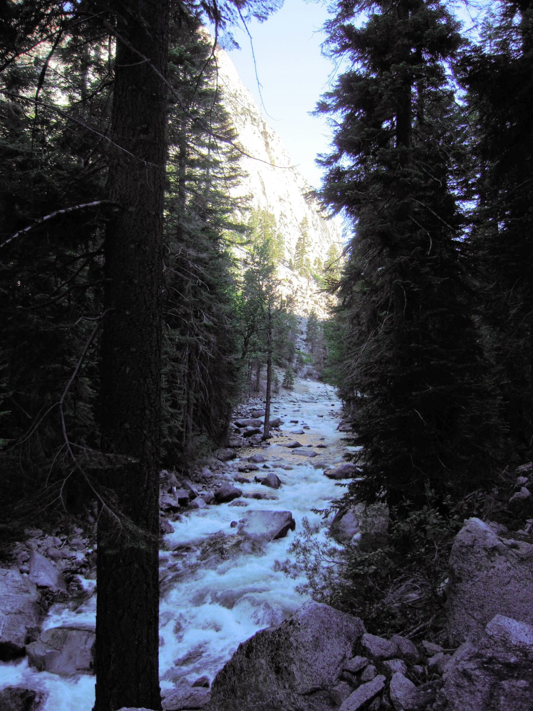
The day started fast and easy following the gentle grade of the Kern River. I chewed up 7.5 miles before the coffee even kicked in and I was none the worse for wear.
The reprieve was brief, however. The sun was rising overhead, I still had 5 days of food in my pack, and I was facing 1600’ of shadeless climbing in 90+ degree heat. The hardest part of the trip was approaching, and I was still many miles from the highest point of Mount Whitney.
After incorrectly reading my map, I began the ascent with just a liter of water believing that I could easily refill along Wallace Creek. In reality, the creek would follow me for miles, always just out of reach down a steep scree field that I dared not attempt. At this point in the trip I had not seen mammal (human or otherwise) for nearly 24 hours and 20 miles of trail. My dehydrated mind was beginning to wander odd places, wondering why it had been so long since I’d last seen someone on such a popular trail. I compulsively checked the map, sure I’d made a wrong turn, but each time the topography would agree with my position.
But soon I reached a water source, and with my head dunked in cool water and bottles full again, the waves of worry receded and were replaced by the tides of reason. After another half hour of hiking, I reached the intersection with the famous John Muir Trail.
I left the roller coaster ride of complete solitude of the High Sierra Trail and joined the cattle drive of the John Muir Trail. At once I noticed a difference in the demeanor of the average hiker. Gone were the backpacker families and middle-aged friends “havin’ a weekend away from the ladies/dudes.” Whereas I had previously stopped for a quick chat with every hiker I met, now I was crossing paths with the ultralight bros, alternative lifestylers, and couples who were no longer speaking to each other. These tanned and tired hikers seemed laser focused on the final summit just one day ahead. Little did they realize, that that summit would soon be focusing its lasers on them.
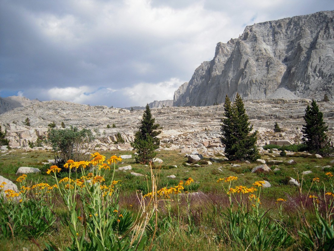
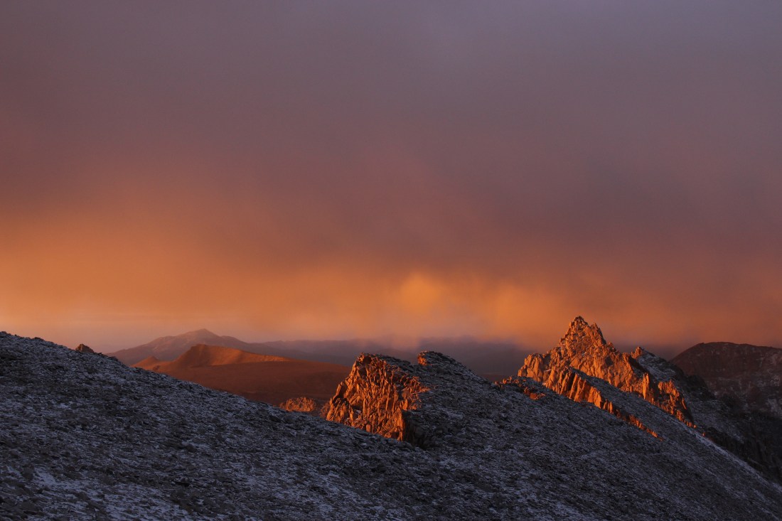
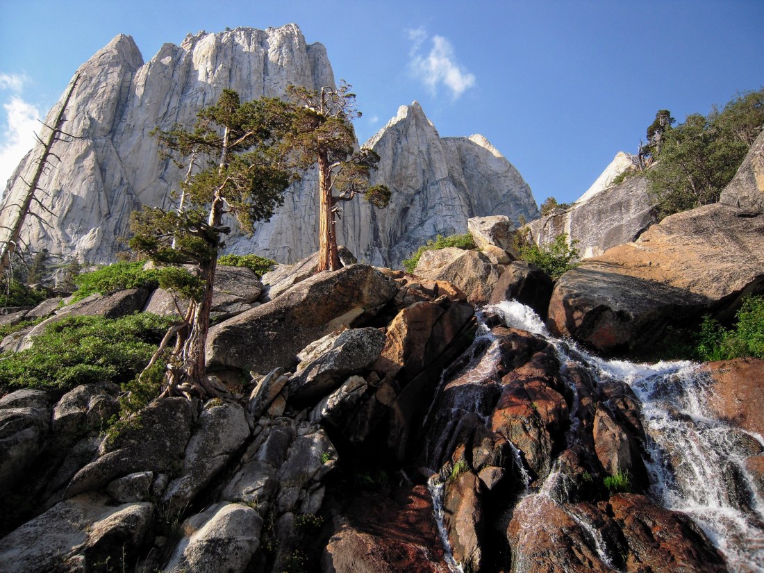
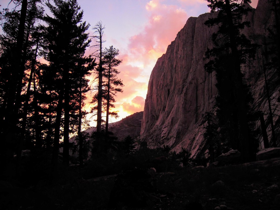
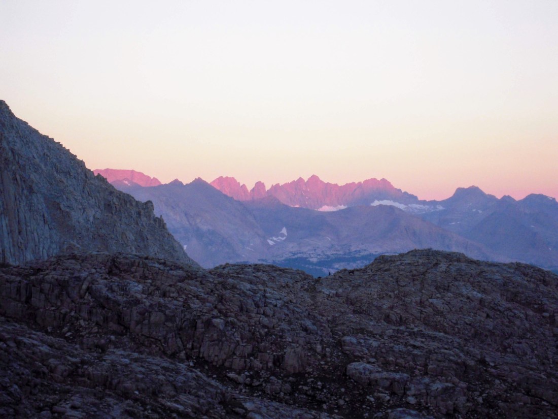
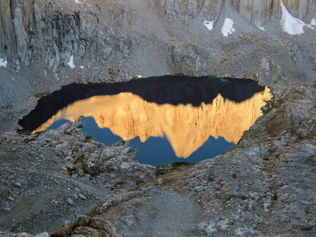
The evening started calm enough. Around 5pm, a glance up showed light clouds against a clear sky. At this point, I had expected any afternoon thunderstorms to already be building or have struck. I began my final short leg to Guitar Lake, a popular last stop for water and camping before the push to the summit of Mount Whitney. Sitting just above 11,000’, Guitar Lake lies in the fist-shaped valley that includes Mount Hitchcock, Mount Young, Mount Hale, Mount Russell, and (surprisingly unimposing from this vantage) Mount Whitney.
I’ve often heard the adage that “weather turns quickly in the mountains,” and on several occasions I’ve seen this to be true, with a clear day transitioning to storm within an hour. But never before have I seen a mostly clear sky transition to tempest as quickly as I did at Guitar Lake. I was just opening my tent bag as the first warm raindrops splashed down. By the time my rainfly was erected less than 3 minutes later (assembling the tent body having since been abandoned to save time), the heavens had opened and a half inch of water had pooled at my ankles.
As I crawled into my tent, drenched and wearing the light clothing I had used to keep cool in the hike in, I caught the eye of another hiker who had also arrived at the onset of the storm. As we made eye contact, lightening struck not more than a stone’s throw from our campsite. Both of us reflexively flinched from fear as if struck ourselves. Eventually we straightened and shared a nervous smile before ducking into tents.
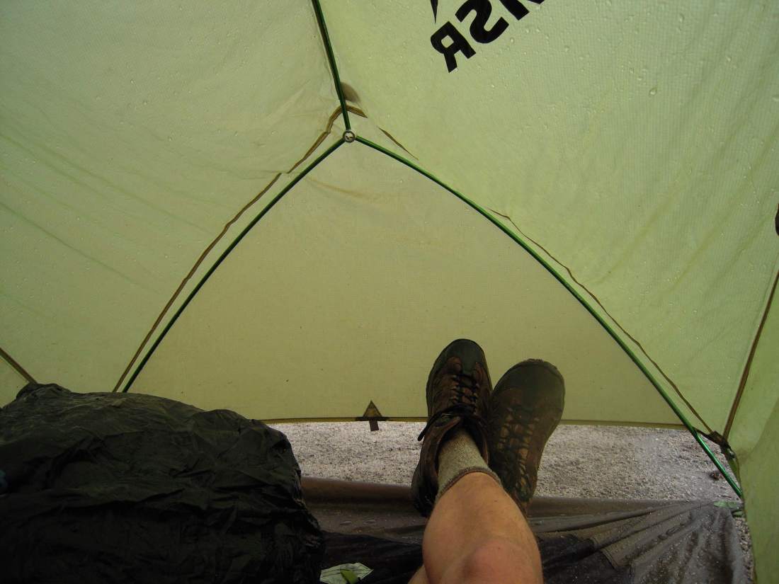
I sat in silence with my hands clamped over my ears for well over an hour, unsure what to do next. My tent was not in sleepable condition; I was in a campsite with decent runoff, and yet icy water managed to pool around me. If the water rose any higher, my pack (which contained my sleeping bag and insulating layers) would be drenched. Thoughts of descending were pounded away by the sound of large hailstones hitting my rainfly. As I sat shivering in my shorts soaked by hail-cooled rainwaters, I considered how long I would wait before pulling out my dry insulating layers in order to avoid hypothermia.
And after a few false letups, the storm did finally pass. It left behind a beautiful alpine evening, with its fury diminishing as quickly as it had built.
Day 4: To Mount Whitney
7 miles, 4,500’ climbing
The excited rustling in camp the morning before summiting is always audible. Whitney may be a walk-up, but it bears special significance well beyond its status as highest peak in the lower 48. For JMTers, it is the culmination of what is often multiple weeks spent on the trail. For PCTers, it will be the highest point of their long journey. For HSTers like me, it is the conclusion of what is often their longest thru-hike to date.
Well before alarms began ringing, but well after ambitious hikers had left to meet the sunrise at the summit, I began packing up my gear in anticipation. I quietly said goodbye to the friends with whom I had weathered the previous night’s storm and began climbing.
Excitement to reach the summit carried me quickly to Trail Crest, where the thru hikes of the west meet the more popular trail to Whitney from the east.

At this point, the trail-seasoned hikers of the JMT gave way to the daytrippers of Whitney Portal. They appeared to range from seasoned mountaineer on a casual hike, to underdressed and underprepared hiker with a sunburn, all the way down to “guy who watched Survivorman once.” Hats off to the rangers who keep the whole thing reasonably sane and safe.
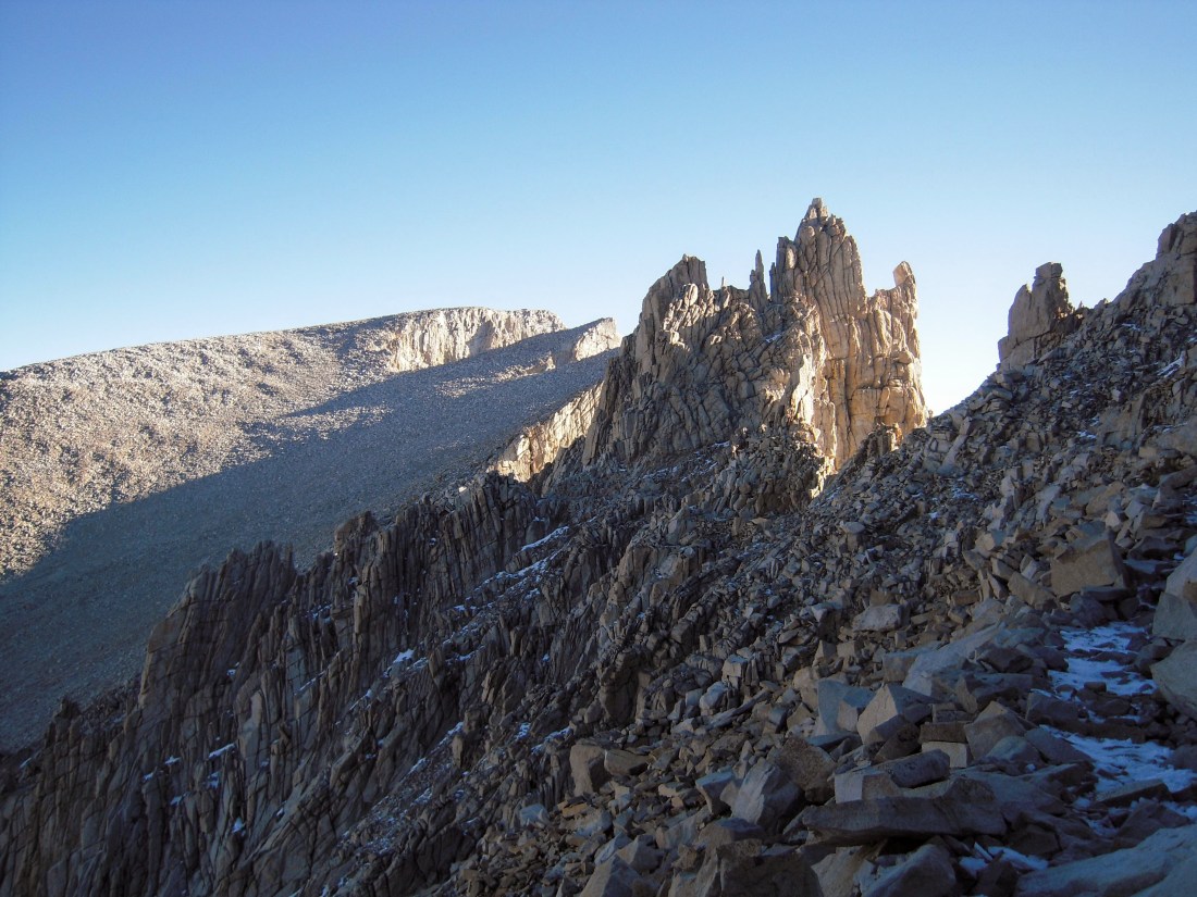
A few spots were mighty icy and steep following the hail storm the night before. These were easy to overlook on an otherwise manicured trail, and I found myself taking a few uneasy slips towards a steep boulder field.
After a cool morning of gradual climbing, I reached the highest point of my journey across the Sierra.
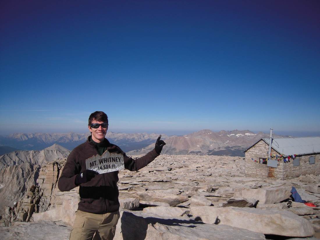
Needless to say, I was happy to briefly be the highest point in the lower 48 and proud to have reached my goal in under 72 hours from leaving Crescent Meadow.
But despite my joy at reaching the top, I only spent a few minutes at the summit. A guy to my right lit a joint and proclaimed himself “the highest guy in the world.” Meanwhile a tired couple to my left fought each other over nothing, engaged in what I’d call an “altitude quarrel.” About 20 other hikers circled around, trying to snap pictures without getting one another in the frame.
As I watched the hikers around me deservedly relish in their accomplishment in their own unique ways, I knew that although this may be the “high point” of my trip, it would not be the “highlight.” The real majesty of this trip was in the moments deep in the wilderness, alone for hours on end and with no distraction but for the granite rising up around me and earth falling away below me. Summiting Whitney felt like an accomplishment, but was nowhere near as difficult as the little milestones that had to fall into place to even reach its base.
Day 4.5: to Whitney Portal (and home)
9 miles hiking, 370 miles driving
I include this section separately because I, like most climbers, had written off my descent as “a long easy walk downhill.” In reality, it was far more difficult than the climb to Whitney’s summit. Several long days of hiking at altitude combined with still having about 4 days worth of food stuffed in my pack made for an arduous trek to the parking lot.
Many parts of the descent were made more difficult by the heavy rain and hail that had fallen the night before and that had turned entire sections of trail into small creeks. My feet got wet early and soon they were aching badly from all the abuse.
Inspired by the rangers I had met and read about during my journey, I took a break every time I found and collected a piece of garbage on the trail. I told myself this was to help keep this heavily trafficked area clean, but honestly, my feet hurt like hell and I wanted a good excuse to sit down.
But after crawling down the seemingly endless switchbacks into the scorching Owens Valley, I finally made it to Whitney Portal where I could discard my unused wag bag and high five the JMTers gathered in the parking lot.
In what seems like an eight hour blur of coffee and hamburgers, I made my way back to San Francisco. To summarize a few highlights:
I happily drove four extremely stinky hitchhiking JMTers into Lone Pine, which is when I discovered that a Subaru Outback does not actually have adequate braking power for such a load in 110 degree weather (but at least the burning asbestos covered the smell of the body odor).
I ordered the “Mount Whitney Burger” at a local diner, which was actually just two normal burgers and a side salad. The waiter seemed increasingly alarmed each time he refilled my water.
I crept up highway 395 at a sluggish pace, being careful not to overheat my engine on the scorching-hot high-altitude passes. I laughed guiltily each time an impatient driver, having whipped around me moments earlier, had to pull off the road while their radiators boiled over from the strain.
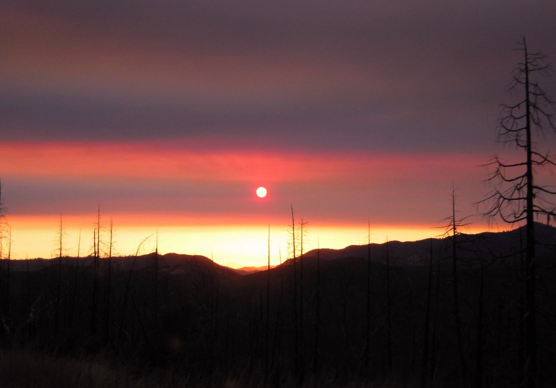
As I finally crossed over Tioga Pass and made my way west along highway 120, I hoped for the best for those living near the west entrance of Yosemite. Clouds of smoke blowing off the Ferguson Fire obscured the granite walls and turned the sky a deep red.
Conclusion
What went well
I couldn’t believe my luck with finding a willing partner in crime to trade cars with me prior to this trip. Watching tired hitchhikers stick out their thumbs in Lone Pine on a 110 degree day made me happy to drive home in my own car.
All my gear performed admirably for its age, but I really won’t go into that here. Feel free to ask me if you have questions about something I carried.
What I would do differently
I carried enough food to last me 6+ days on this trip, but only stayed out 4 and only ate 3 days worth. Turns out that it’s hard to eat much when you walk all day at altitude. I was also drinking about 6 liters of water a day to replace sweat in the heat, but not getting nearly enough salt. Now that I know my solo pace, I would plan differently and carry far less.
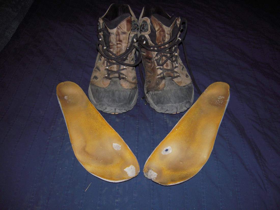
My boots kind of fell apart day 2. They weren’t bad boots when I got them, but I’ve had them for over a decade and it’s time they get replaced. They’re no longer waterproof enough keep dry, but also not breathable enough to be comfortable. And I think the picture below says it all with regards to the insoles.
It’s definitely time to upgrade my camera. Solo hiking offered many more convenient opportunities to stop and snap pictures, and the point-and-shoot doesn’t quite capture the grandeur properly.
Most importantly, I would bring some friends! A solo adventure pushing my pace was a lot fun, but I had to write this whole blog just to share it with someone!
Final Words
This trip and the book I read along the way (“The Last Season” by Eric Blehm) made me pause and think more than ever about land conservation and those who manage our wild places. The nearly undisturbed stretches of wilderness within Sequoia-Kings Canyon are inspiring to visit as much for their vistas as their raw untamedness.
But SEKI wasn’t always this way. Before the Wilderness Act of 1964 increased management funding and imposed stricter regulations on visitors, the park was turning into an increasingly front-country destination. Luckily, the trend was reversed and we have the backcountry wonderland that exists today.
I’ve sometimes caught myself wishing I could ride a mountain bike down a wilderness trail, or been ticked off that I couldn’t get a limited permit to a cool area. But I realize now that it’s important to step back, look at the bigger picture, and remember that the world’s wildest places will be the ones that I never visit.

Whow ! What a fantastic trip you made ! High Sierra Trail looks like a great adventure .In my younger days ,I used to spend my Summer holiday mountain climbing , so I appreciate the challenge .Thank you for sharing beautiful pictures …I really enjoyed the ride 🙂
LikeLiked by 1 person